When your dog is missing, recent GPS pings can turn panic into a sequence of smaller, smarter search decisions. The goal is not to stare at a dot and chase it blindly; it is to read the last confirmed locations, understand what the tracker may be missing, and build a safe recovery plan around your dog’s likely movement.
Searches near highways, active railroad tracks, restricted land, flood zones, or dangerous terrain should be handled with local animal control, law enforcement, or trained recovery professionals in line with local laws and safety requirements.
Main points
- Treat the last location as evidence, not a promise that your dog is still standing there.
- Screenshot every update with the time shown, because app maps can refresh, shift, or lose useful history.
- Use the last three or more location points to estimate direction, speed, and likely obstacles.
- Search quietly near cover, water, familiar routes, and low-traffic hiding places before widening the area.
- If updates stop, think through battery, cellular coverage, collar loss, indoor shelter, and terrain before assuming the tracker failed.
Step 1: Lock down the last confirmed location
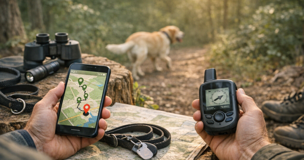
Open the tracker app and resist the urge to start driving immediately. First, record the basics: the last update time, the location shown on the map, the direction of earlier points if visible, and any battery or signal status the app provides. Take screenshots of the map at different zoom levels so you have the street view, nearby landmarks, and the broader neighborhood context.
The phrase “last seen” can be misleading with GPS trackers. It may mean the last time the device successfully reported a location, not the exact moment your dog reached that spot. A cellular tracker may have captured a GPS location but failed to upload it until it found service, or it may show an older point because it cannot connect. That is why time matters as much as the pin.
If the tracker is a cellular model, read the app’s status carefully and check the manufacturer’s support notes for what each status means. For example, a tracker such as Whistle GO Explore depends on network conditions, device charge, fit, and correct setup just like other app-based GPS collars. A clean map does not automatically mean the data is live.
Step 2: Build a simple timeline instead of chasing one dot
A single GPS ping tells you where the collar was reported at one moment. A sequence tells you much more. Write down the last several update times in order, along with the nearest road, trail, yard, field, or landmark. Even three points can show whether your dog was drifting along a fence line, cutting across a neighborhood, following a creek bed, or circling back toward home.
Look for realistic movement, not perfect lines. Dogs do not travel like delivery trucks. A frightened dog may double back, duck behind buildings, move through gaps in fences, or freeze under a porch for long stretches. A social dog may move toward people, dogs, food smells, playgrounds, dog parks, or familiar houses. A scent-driven hound may keep moving with its nose down and ignore your calls.
Mark the most recent confirmed point as the center of your first search zone, then draw outward in practical rings. In a dense neighborhood, that may mean the surrounding blocks, alleys, garages, sheds, and yards. In open land, it may mean tree lines, drainage ditches, barns, livestock areas, and the edges of fields. If the last update was several hours ago, expand the zone based on your dog’s age, fitness, temperament, and how scared they are likely to be.
Step 3: Read the map like a dog, not like a driver
Roads are useful for humans, but dogs often follow easier or quieter paths. When you look at the map, ask what would make sense from the ground. Is there a creek or drainage route running behind the last ping? Is there a school field, golf course, cemetery, construction site, apartment complex, or wooded strip nearby? Are there backyard gates, gaps under fences, culverts, or trailheads that could explain the next move?
Recent GPS pings are most helpful when you combine them with physical barriers. A nervous dog may hesitate at a wide road but slip through a hedge. A fence jumper may keep moving behind houses because it feels safer than the sidewalk. A dog lost during a hike may stay close to the trail at first, then drop into shade, brush, or water as stress and fatigue build.
When possible, send one person to the last confirmed point and another to the likely exit route rather than having everyone converge noisily on the same spot. Keep voices calm. Do not form a shouting search party around a fearful dog; many dogs in flight mode move away from pressure, even from people they love.
Step 4: Check why the updates may have stopped
A stopped update does not always mean the collar is off or the dog is far away. It may mean the device is under cover, inside a building, in weak cellular service, low on battery, or temporarily unable to send data. It may also mean the collar slipped off, got snagged, or was removed by someone who found the dog.
Work through these checks before changing your plan:
- Time since last update: A two-minute-old location deserves immediate attention. A two-hour-old point needs a wider search pattern.
- Battery status: If the app shows low charge, preserve your phone battery, keep screenshots, and assume updates may become less frequent or stop.
- Coverage clues: If the last point is in a valley, rural area, wooded park, campground, or metal building, network limitations may be part of the problem.
- Collar fit: If your dog is small, narrow-headed, recently groomed, or prone to backing out of collars, consider that the tracker might no longer be on the dog.
- Water, brush, and buildings: A dog hiding under a deck or inside an open garage may be very close while the device struggles to update clearly.
If your searches often happen in rural areas, mountain towns, hunting land, or places with unreliable cellular coverage, it helps to understand tracker limitations before the next emergency. The guide on choosing a dog tracker when cell service is weak explains why some devices behave differently once you leave strong network areas.
Step 5: Search the first zone quietly and systematically
At the last confirmed location, pause before calling. Listen for tags, barking, whining, movement in brush, or dogs reacting from nearby yards. Look low and close: under porches, behind trash cans, inside open garages, behind sheds, under parked vehicles, along fence corners, and in shaded landscaping. Many lost dogs hide within a surprisingly small area, especially after a scary escape.
Use food scent carefully. If your dog is nearby but panicked, a strong-smelling food trail or a familiar blanket may help draw them toward a safe spot. Avoid crowding the area with strangers or loud voices. One calm person sitting or crouching may be less threatening than several people walking directly toward the dog.
If you see your dog, do not sprint after them. Turn your body sideways, lower your posture, soften your voice, and avoid direct pursuit. Some owners have better results sitting down, opening a car door, rustling a familiar treat bag, or pretending not to chase. The right approach depends on the dog, but the rule is consistent: reduce pressure.
Step 6: When the map moves, plan your intercept
If a new update appears, compare it to the timeline before reacting. Did the collar jump an unrealistic distance? Is the point near a road that matches your dog’s likely route? Is it showing the same general direction as earlier updates? Map errors and delayed uploads can happen, so confirm the pattern before sending everyone across town.
When the movement looks plausible, pick a safe intercept point ahead of the direction of travel rather than chasing from behind. For a dog moving along a trail, that might be a trailhead, parking lot, bridge, or familiar water stop. In a neighborhood, it might be a quiet corner, a friend’s yard, or the route back toward home. Keep one person monitoring the app and another moving safely on foot or by car.
Do not block traffic, trespass, or enter unsafe areas to reach a dot. If the location points toward private property, knock, call, or ask animal control for help. A respectful, organized request gets better cooperation than a panicked search through someone’s yard.
Step 7: If the collar is found without the dog
Finding the tracker or collar is discouraging, but it is still valuable evidence. Photograph where it was found before moving it. Look for signs: was it near a fence, snagged on brush, lying by a road, or placed somewhere visible by another person? That detail can tell you whether your dog slipped free, pushed through cover, was picked up, or continued in a likely direction.
At that point, shift from live tracking to standard lost-dog recovery. Expand the search radius from the collar location, post clear recent photos, call nearby shelters and veterinary clinics, notify microchip registries, and ask neighbors to check cameras, garages, sheds, and fenced yards. Keep the tone of posts specific: include the dog’s name, size, color, collar status, last confirmed area, and instructions not to chase if the dog is skittish.
Step 8: After your dog is safe, fix the weak points
Once your dog is home, take a breath before judging yourself. Most lost-dog scares reveal a chain of small issues: a loose collar, a gate routine, a dead tracker battery, a door-dashing habit, an ID tag that was hard to read, or a device that was not tested in the places you actually visit.
Run a recovery drill within the next few days. Charge the tracker, check the collar fit, confirm your contact details, test location updates near home and on a normal walk, and make sure another trusted person knows how to access the tracker account or receive shared location information. Add a readable ID tag and consider backup safety gear for the situations that caused the escape.
For dogs with a history of bolting, fence climbing, slipping collars, or panicking during travel, the dog safety gear buying guide for escape-prone dogs can help you think through identification, visibility, harness fit, tracker attachment, and everyday prevention without assuming any one tool is foolproof.
FAQ
How old can a GPS ping be and still help?
Even an older ping can help if it is the last reliable location. Treat it as a starting point, then widen the search based on elapsed time, terrain, roads, weather, and your dog’s behavior.
Why does the app show my dog in one place when they are not there?
The app may be showing a stale update, a delayed upload, or an approximate location. Check the timestamp before assuming the dog is still at the pin.
Should I keep refreshing the tracker app constantly?
Refresh when needed, but assign one person to monitor the app so others can search safely. Keep your phone charged and save screenshots in case the map history changes.
What if the last ping is on private property?
Do not trespass. Contact the property owner, knock if it is safe and appropriate, or ask local animal control or law enforcement for help accessing the area legally.
Can a Bluetooth tag replace a GPS tracker for lost-dog recovery?
Usually not. Bluetooth tags can help at short range or through nearby network users, but they do not provide the same kind of location reporting as a GPS tracking device.
Key takeaways
A lost-dog tracker works best when you treat each update as part of a recovery plan, not as a magic answer. Save the data, build a timeline, search the ground realistically, and adjust for battery, coverage, collar fit, and your dog’s fear level. The calmer and more organized the first hour is, the better your chances of turning a last known location into a safe reunion.